TORUS
Targeted Observations by Radar and UAS of Supercells
Summary
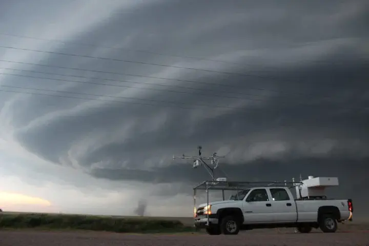
More than 50 researchers and students are deploying a wide-ranging suite of instruments to collect data on supercell thunderstorms across the Great Plains. The TORUS project aims at understanding the relationships between severe thunderstorms and tornado formation. Multiple research teams will follow severe thunderstorms to study how factors like wind speed, temperature, humidity and pressure may reveal the small-scale structures in a supercell storm and how it contributes to tornado formation. The goal is to use the data collected to improve conceptual models of supercell thunderstorms. Aims of the project include observing airstreams going into and out of the storms and how these relate to changes in storm behavior and tornado development. BLISS researchers are mostly focused on the design, deployment, and analysis of data collected by NSSL’s mobile lidar facility. Radiosondes and other instrumentation like mobilie mesonet, radar, and even uncrewed aircraft sysem (UAS) data can be useful in these anayses. TORUS was orginally planned as a two year experiment for 2019 and 2020. After the 2019 deployment, COVID postponed year 2 until 2022. During 2022, the UAS teams from University of Colorado were unable to fly, resulting in an incomplete deployment. Additional NSF funds were awarded (and supplemented by NOAA support) for a smaller, more focused third year called TORUS-LItE in 2023.
Funding Agencies
NOAA, NSF
Platforms
- Lidar truck