BLISS Collaborations with OU ARRC: Advancing UAS and Lidar Technologies
The BLISS (Boundary Layer Integrated Sensing and Simulation) team is proud to highlight our ongoing collaborations with the University of Oklahoma’s Advanced Radar Research Center (ARRC). These partnerships showcase our commitment to pushing the boundaries of atmospheric science and technology.

UAS for Radar Antenna Calibration
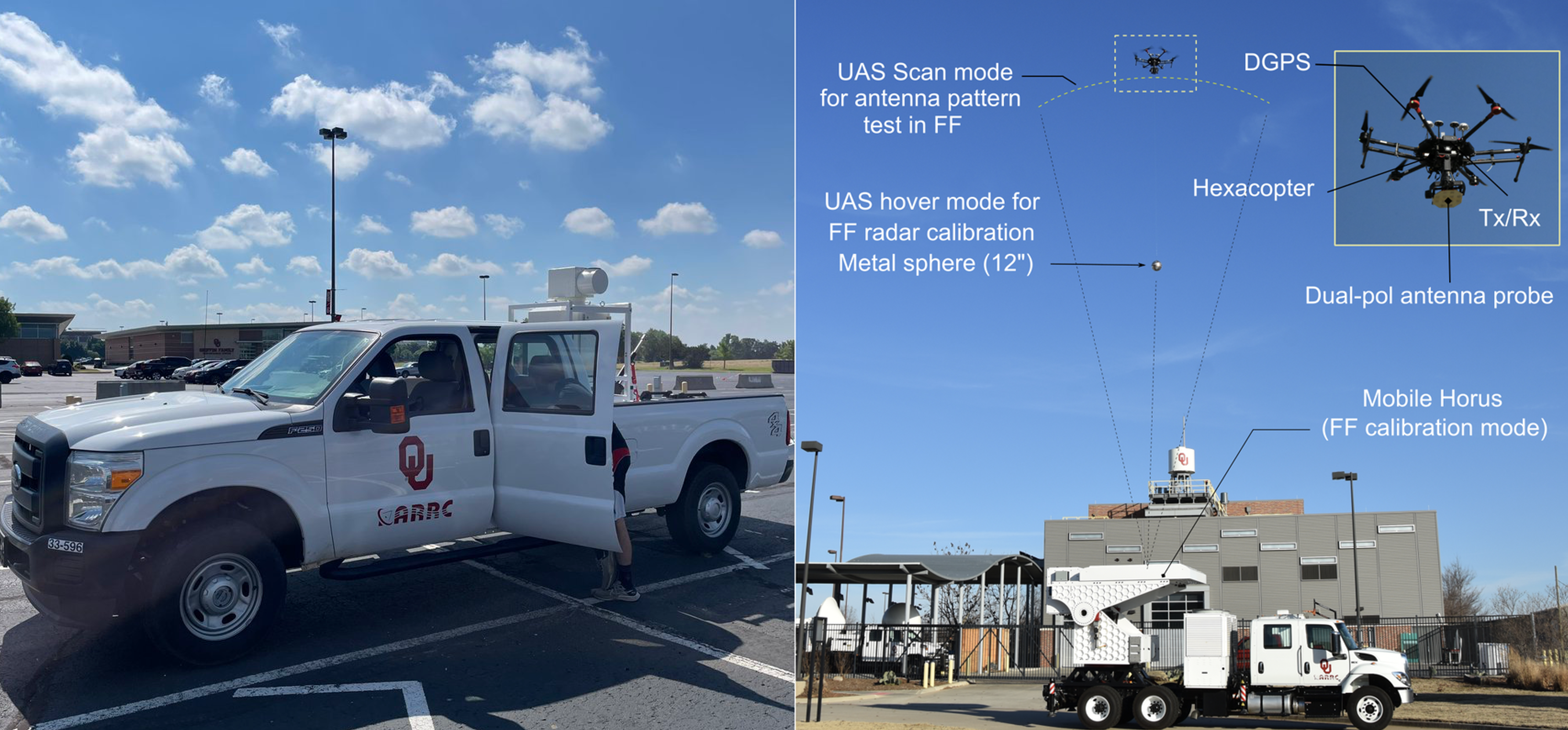
One exciting collaboration involves BLISS team member Tony Segales working with ARRC on using Uncrewed Aerial Systems (UAS) for radar antenna calibration. This innovative approach offers several advantages over traditional methods:
- Flexibility: UAS can perform calibrations in various environments, including deployed radar sites.
- Practicality: It overcomes the space limitations of indoor facilities, especially for large S-band weather radar systems.
- Accuracy: The method can account for real-world factors like radomes, towers, and local environmental conditions. The team has developed a UAS RF test system using a commercial hexacopter platform with a customized RF transceiver and antenna probe. This system allows for:
- Far-field calibration and characterization of radar antennas
- Polarimetric radar calibration using a tethered metallic sphere
- Antenna pattern measurements with minimal ground and clutter contamination This groundbreaking work has been documented in several scientific publications, demonstrating its potential to revolutionize radar calibration techniques.
Enhancing LiDAR Technology for Meteorology
In a separate but equally important collaboration, BLISS researchers Josh Gebauer and Petra Klein are working with ARRC, OU, and international partners to evaluate and enhance LiDAR technology for meteorological applications, particularly in severe weather scenarios.
This collaboration leverages BLISS’s expertise in Doppler LiDAR applications for meteorology and severe weather. Key aspects of this work include:
- Evaluating current LiDAR technologies for atmospheric sensing
- Developing new methodologies for applying LiDAR data to severe weather forecasting
- Exploring the integration of LiDAR data with other remote sensing technologies
- Enhancing our understanding of boundary layer processes in severe weather environments By combining the strengths of BLISS and ARRC, this collaboration aims to push the boundaries of what’s possible in atmospheric remote sensing and improve our ability to monitor and predict severe weather events.
Looking Ahead
These collaborations exemplify the innovative spirit of BLISS and our commitment to advancing atmospheric science through interdisciplinary research. As we continue to work closely with ARRC and other partners, we anticipate further breakthroughs that will enhance our understanding of the atmosphere and improve our ability to monitor and predict weather phenomena.
Stay tuned for updates on these exciting projects and their potential impacts on the field of meteorology!